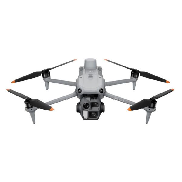
DJI Matrice 350 RTK, LIDAR + RGB (DJI Care Basic 2Year)
13992
product-template-default,single,single-product,postid-17670,theme-eden,eden-core-1.0.4,woocommerce,woocommerce-page,woocommerce-no-js,eden-theme-ver-3.1,ajax_fade,page_not_loaded,show_loading_animation,wpb-js-composer js-comp-ver-6.4.2,vc_responsive
Title Image

DJI Matrice 350 RTK, LIDAR + RGB (DJI Care Basic 2Year)


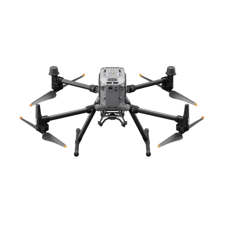
Matrice 350 s RTK modulom, LIDARom Zenmuse L1 i Zenmuse P1 RGB 45MPix kamerom


Pogledaj cjenik


Nadograđena vodeća platforma za bespilotne letjelice, Matrice 350 RTK postavlja nove standarde u industriji. Ova platforma bespilotnih letjelica sljedeće generacije ima potpuno novi sustav video prijenosa i iskustvo upravljanja, učinkovitiji sustav baterija i sveobuhvatnije sigurnosne značajke, kao i robusnu nosivost i mogućnosti proširenja. Ima punu snagu za ubrizgavanje inovativne snage u bilo koju zračnu operaciju.


Ostanite stabilni uz novi sustav prijenosa O3 Enterprise Transmission


Matrice 350 RTK prihvaća DJI O3 Enterprise Transmission, koji podržava trokanalne 1080p HD prijenose uživo i maksimalnu udaljenost prijenosa od 20 km. I dron i daljinski upravljač imaju sustav primopredajnika s četiri antene, koji može inteligentno odabrati dvije optimalne antene za prijenos signala, dok četiri antene primaju signale istovremeno. Na taj su način značajno poboljšane mogućnosti zaštite od smetnji, a optimizirana je stabilnost prijenosa.


Ključne značajke


Maksimalno vrijeme leta od 55 minuta
IP55 ocjena
DJI O3 Enterprise prijenos
DJI RC Plus

400 ciklusa baterije
6-smjerno očitavanje i pozicioniranjeFPV kamera za noćno gledanje
Podrška za više payloada


Opremljen sa 7-inčnim zaslonom visoke svjetline, DJI RC Plus podržava Dual Operator Mode i dolazi sa standardnom WB37 vanjskom baterijom koja nudi vrijeme rada do šest sati, zadovoljavajući različite radne potrebe. Sa stupnjem zaštite IP54, DJI RC Plus otporan je na prašinu i vodu kako bi pouzdano radio u lošem vremenu. Radna temperatura je od -20° do 50° C (-4° do 122° F), podržavajući 24-satni rad čak iu jako vrućim ili hladnim okruženjima.

Postoji nekoliko tipki i kotačića na prednjoj, stražnjoj i gornjoj strani daljinskog upravljača za brz rad. Funkcije gumba mogu se prilagoditi navikama korisnika i pružiti intuitivno i fleksibilno iskustvo.

Matrice 350 RTK opremljen je novim TB65 sustavom s dvostrukom baterijom, koji podržava zamjenu baterije tijekom rada i omogućuje višestruke letove bez isključivanja.

Baterija se može puniti do 400 ciklusa, čime se smanjuje trošak jednog leta. Matrice 350 RTK dizajniran je sa šesterosmjernim binokularnim vidnim sustavom i infracrvenim senzorskim sustavom za šesterosmjernu svjesnost, pozicioniranje i mogućnosti detektiranja prepreka, pružajući sveobuhvatnu zaštitu tijekom leta.


Kartiranje visoke preciznosti


Matrice 350 RTK podržava misije Waypoint, Mapping, Oblique i Linear Flight. Možete koristiti Terrain Follow ili Smart Oblique za učinkovito prikupljanje podataka. Zajedno s DJI Terra, možete brzo dobiti HD 2D i 3D digitalne rezultate, omogućujući visokoprecizan i visokoučinkovit rad kartiranja.


DJI Zenmuse L1 LIDAR


Zenmuse L1 integrira Livox Lidar modul, IMU visoke točnosti i kameru s 1-inčnim CMOS-om na 3-osnom stabiliziranom gimbalu. Kada se koristi s Matrice 300 RTK i DJI Terra, L1 tvori cjelovito rješenje koje vam daje 3D podatke u stvarnom vremenu tijekom cijelog dana, učinkovito hvatajući detalje složenih struktura i isporučujući vrlo precizne rekonstruirane modele.

– Frame Lidar s do 100% učinkovitim rezultatima oblaka točaka
– Domet detekcije: 450 m (80% refleksije, 0 klx) / 190 m (10% refleksije, 100 klx)
– Efektivni broj točaka u sekundi: 240.000
– Podržava 3 povrata [3]
– Line Scan Mode i Non-repetitive Scan Mode
– 20 MP
– 1-inčni CMOS
– Mehanički zatvarač
– Preciznost: 0,025° (okret/nagib) / 0,08° (skretanje)
– Vision senzor za točnost pozicioniranja
– GNSS, IMU, RGB Fuzija podataka
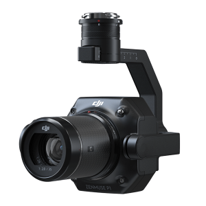


DJI Zenmuse P1 RGB 45MPix kamera


Zenmuse P1 integrira senzor punog kadra s izmjenjivim lećama s fiksnim fokusom na 3-osnom stabiliziranom gimbalu. Dizajniran za fotogrametrijske misije leta, podiže učinkovitost i točnost na potpuno novu razinu.

– Full-frame senzor od 45 MP
– Veličina piksela 4,4 μm
– Snimanje visoke osjetljivosti s niskim šumom produljuje dnevno vrijeme rada
– Fotografirajte svakih 0,7 s tijekom leta
– TimeSync 2.0 usklađuje kameru, kontroler leta, RTK modul i gimbal na razini mikrosekunde
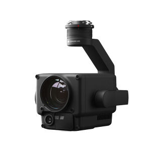


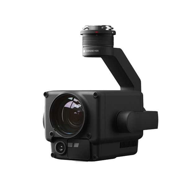
DJI Zenmuse H20 RGB 20MPix kamera


Gimbal i kamera Zenmuse H20 imaju zoom i širokokutnu kameru. Operater se može brzo prebaciti na zumiranu sliku s velikim povećanjem za detaljno promatranje. Zenmuse H20T također ima dugovalnu infracrvenu termalnu kameru, koja pruža i infracrvene i RGB slike istovremeno. I Zenmuse H20 i H20T opremljene su laserskim daljinomjerom, koji pruža informacije o udaljenosti i lokaciji primjenjive u različitim misijama kao što su potraga i spašavanje, inspekcija i još mnogo toga.


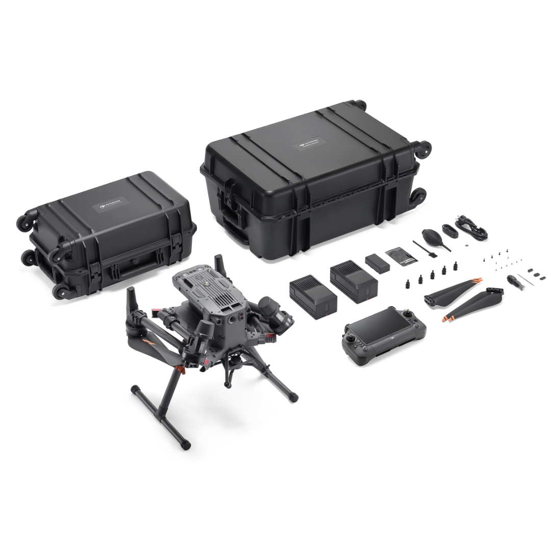
Sadržaj pakiranja


  • Aircraft Body
  • Landing Gear
  • 2110s Propeller (pair)
  • DJI RC Plus Remote Controller
  • WB37 Intelligent Battery
  • Spare Gimbal Damper
  • Screws and Tools
  • Cleaning Tools
  • Rubber Port Cover (Set)
  • Carrying Case
  • DJI Care Basic 2Y


OPCIONALNO: DJI Zenmuse L1 Lidar s gimbalom

OPCIONALNO: DJI Zenmuse P1 RGB kamera 45MPix s gimbalom


Tehničke specifikacije DJI Matrice 350 RTK


Aircraft

  • Dimensions (unfolded, without propellers)

  • 810×670×430 mm (L×W×H)
  • Dimensions (folded, with propellers)

  • 430×420×430 mm (L×W×H)
  • Diagonal Wheelbase

  • 895 mm
  • Weight (with single downward gimbal)

  • Without batteries:
    Approx. 3.77 kgWith two TB65 batteries:
    Approx. 6.47 kg
  • Single Gimbal Damper’s Max Payload

  • 960 g
  • Max Takeoff Weight

  • 9.2 kg
  • Operating Frequency

  • 2.4000-2.4835 GHz
    5.150-5.250 GHz (CE: 5.170-5.250 GHz)
    5.725-5.850 GHzIn some countries and regions, the 5.1GHz and 5.8GHz frequency bands are prohibited, or the 5.1GHz frequency band is only allowed for indoor use. Please refer to local laws and regulations for more information.
  • Transmitter Power (EIRP)

  • 2.4000-2.4835 GHz:
    < 33 dBm (FCC)
    < 20 dBm (CE/SRRC/MIC)5.150-5.250 GHz (CE: 5.170-5.250 GHz):
    < 23 dBm (CE)5.725-5.850 GHz:
    < 33 dBm (FCC/SRRC)
    < 14 dBm (CE)
  • Hovering Accuracy (with moderate or no wind)

  • Vertical:
    ±0.1 m (with vision positioning)
    ±0.5 m (with GNSS positioning)
    ±0.1 m (with RTK positioning)Horizontal:
    ±0.3 m (with vision positioning)
    ±1.5 m (with GNSS positioning)
    ±0.1 m (with RTK positioning)
  • RTK Positioning Accuracy (RTK FIX)

  • 1 cm + 1 ppm (horizontal)
    1.5 cm + 1 ppm (vertical)
  • Max Angular Velocity

  • Pitch: 300°/s
    Yaw: 100°/s
  • Max Pitch Angle

  • 30°
    When in N mode and with the forward vision system enabled: 25°.
  • Max Ascent Speed

  • 6 m/s
  • Max Descent Speed (vertical)

  • 5 m/s
  • Max Tilted Descent Speed

  • 7 m/s
  • Max Horizontal Speed

  • 23 m/s
  • Max Flight Altitude

  • 5000 m
    When using the 2110s propellers and with the takeoff weight ≤ 7.4 kg.7000 m
    When using the 2112 High-Altitude Low-Noise Propellers and with the takeoff weight ≤ 7.2 kg.
  • Max Wind Speed Resistance

  • 12 m/s
  • Max Flight Time

  • 55 minutes
    Measured with Matrice 350 RTK flying at approximately 8 m/s without payloads in a windless environment until the battery level reached 0%. Data is for reference only. Actual usage time may vary depending on the flight mode, accessories, and environment. Please pay attention to reminders in the app.
  • Supported DJI Gimbals

  • Zenmuse H20, Zenmuse H20T, Zenmuse H20N, Zenmuse P1, and Zenmuse L1
  • Supported Gimbal Configurations

  • Single downward gimbal
    Single upward gimbal
    Dual downward gimbals
    Single downward gimbal + single upward gimbal
    Dual downward gimbals + single upward gimbal
  • Ingress Protection Rating

  • IP55
    The IP rating is not permanently effective and may decrease due to product wear and tear.
  • Global Navigation Satellite System

  • GPS + GLONASS + BeiDou + Galileo
  • Operating Temperature

  • -20° to 50° C (-4° to 122° F)

Remote Controller

  • Screen

  • 7.02-inch LCD touchscreen; resolution: 1920×1200; max brightness: 1200 nits
  • Weight

  • Approx. 1.25 kg (without WB37 battery)
    Approx. 1.42 kg (with WB37 battery)
  • Global Navigation Satellite System

  • GPS + Galileo + BeiDou
  • Built-in Battery

  • Type: Li-ion (6500 mAh@7.2 V)
    Charging Type: Use the battery station or USB-C fast charger with a max power of 65 W (max voltage of 20 V).
    Charging Time: 2 hours
    Chemical System: LiNiCoAlO2
  • External Battery (WB37 Intelligent Battery)

  • Capacity: 4920 mAh
    Voltage: 7.6 V
    Type: Li-ion
    Energy: 37.39 Wh
    Chemical System: LiCoO2
  • Ingress Protection Rating

  • IP54
  • Operating Time

  • Built-in Battery: approx. 3.3 hours
    Built-in Battery + External Battery: approx. 6 hours
  • Operating Temperature

  • -20° to 50° C (-4° to 122° F)
  • Operating Frequency

  • 2.4000-2.4835 GHz
    5.725-5.850 GHz
  • Transmitter Power (EIRP)

  • 2.4000-2.4835 GHz:
    < 33 dBm (FCC)
    < 20 dBm (CE/SRRC/MIC)5.725-5.850 GHz:
    < 33 dBm (FCC)
    < 14 dBm (CE)
    < 23 dBm (SRRC)
  • Wi-Fi Protocol

  • Wi-Fi 6
  • Wi-Fi Operating Frequency

  • 2.4000-2.4835 GHz
    5.150-5.250 GHz
    5.725-5.850 GHz
  • Bluetooth Protocol

  • Bluetooth 5.1
  • Bluetooth Operating Frequency

  • 2.4000-2.4835 GHz

Video Transmission

  • Video Transmission System

  • DJI O3 Enterprise Transmission
  • Antenna

  • 4 video transmission antennas, 2T4R
  • Max Transmission Distance (unobstructed, free of interference)

  • 20 km (FCC)
    8 km (CE/SRRC/MIC)
  • Max Transmission Distance (with interference)

  • Low Interference and Obstructed by Buildings: approx. 0-0.5 km
    Low Interference and Obstructed by Trees: approx. 0.5-3 km
    Strong Interference and Unobstructed: urban landscape, approx. 1.5-3 km
    Medium Interference and Unobstructed: suburban landscape, approx. 3-9 km
    Low Interference and Unobstructed: suburb/seaside, approx. 9-20 kmMeasured with FCC compliance in unobstructed environments with typical interference at a flight altitude of approximately 120 m. Data is for reference only. The actual transmission distance may vary depending on the environment’s obstruction and interference conditions. Please pay attention to reminders in the app.

Vision System

  • Obstacle Sensing Range

  • Forward/Backward/Left/Right: 0.7-40 m
    Upward/Downward: 0.6-30 m
  • FOV

  • Forward/Backward/Downward: 65° (horizontal), 50° (vertical)
    Left/Right/Upward: 75° (horizontal), 60° (vertical)
  • Operating Environment

  • Surfaces with discernible patterns and adequate lighting (lux > 15)

Infrared Sensing System

  • Obstacle Sensing Range

  • 0.1-8 m
  • FOV

  • 30° (±15°)
  • Operating Environment

  • Large, diffuse, and reflective obstacles (reflectivity > 10%)

LED Auxiliary Light

  • Effective Illumination Distance

  • 5 m
  • Illumination Type

  • 60 Hz, solid glow

FPV Camera

  • Resolution

  • 1080p
  • FOV

  • 142°
  • Frame Rate

  • 30fps

Intelligent Flight Battery

  • Model

  • TB65
  • Capacity

  • 5880 mAh
  • Voltage

  • 44.76 V
  • Type

  • Li-ion
  • Energy

  • 263.2 Wh
  • Weight

  • Approx. 1.35 kg
  • Operating Temperature

  • -20° to 50° C (-4° to 122° F)
  • Ideal Storage Temperature

  • 22° to 30° C (71.6° to 86° F)
  • Charging Temperature

  • -20° to 40° C (-4° to 104° F)
    When the ambient temperature is below 5° C (41° F), the battery will trigger the auto-heating function. Charging at low temperatures may reduce battery life. It is recommended to charge at 15° to 35° C (59° to 95° F).
  • Charging Time

  • With a 220V power supply, it takes approximately 60 minutes to fully charge two TB65 Intelligent Flight Batteries and approximately 30 minutes to charge them from 20% to 90%.
    With a 110V power supply, it takes approximately 70 minutes to fully charge two TB65 Intelligent Flight Batteries and approximately 40 minutes to charge them from 20% to 90%.

Intelligent Battery Station

  • Dimensions

  • 580×358×254 mm (L×W×H)
  • Net Weight

  • Approx. 8.98 kg
  • Compatible Stored Items

  • Eight TB65 Intelligent Flight Batteries
    Four WB37 Intelligent Batteries
  • Input Voltage

  • 100-120 VAC, 50-60 Hz
    220-240 VAC, 50-60 Hz
  • Max Input Power

  • 1070 W
  • Output Power

  • 100-120 V: 750 W
    220-240 V: 992 W
  • Operating Temperature

  • -20° to 40° C (-4° to 104° F)

DJI Zenmuse L1 LIDAR


  • Product Name

  • Zenmuse L1
  • Dimensions

  • 152×110×169 mm
  • Weight

  • Approx. 900 g
  • Power

  • 30 W
  • IP Rating

  • IP44
  • Supported Aircraft

  • Matrice 300 RTK
  • Operating Temperature Range

  • -20° to 50° C (-4° to 122° F)
  • Storage Temperature Range

  • -20° to 60° C (-4° to 140° F)

System Performance

  • Detection Range

  • 450 m @ 80% reflectivity, 0 klx;
    190 m @ 10% reflectivity, 100 klx
  • Point Rate

  • Single return: 240,000 pts/s;
    Multiple return: 480,000 pts/s
  • System Accuracy

  • Horizontal: 10 cm @ 50 m;
    Vertical: 5 cm @ 50 m
  • Real-time Point Cloud Coloring Modes

  • True color; coloring by reflectivity; coloring by elevation

Lidar

  • Ranging Accuracy

  • 3 cm @ 100 m
  • Maximum Returns Supported

  • 3
  • Scan Modes

  • Repetitive line scan mode, non-repetitive petal scan mode
  • FOV

  • Repetitive line scan: 70.4°×4.5°;
    Non-repetitive scan: 70.4°×77.2°
  • Laser Safety

  • Class 1

Inertial Navigation System

  • IMU Update Frequency

  • 200 Hz
  • Accelerometer Range

  • ±8 g
  • Angular Velocity Meter Range

  • ±2000 dps
  • Yaw Accuracy

  • Real-time: 0.18°, Post-processing: 0.08°
  • Pitch / Roll Accuracy

  • Real-time: 0.03°, Post-processing: 0.025°

Auxiliary Positioning Vision Sensor

  • Resolution

  • 1280×960
  • FOV

  • 95°

RGB Mapping Camera

  • Sensor Size

  • 1 inch
  • Effective Pixels

  • 20 MP
  • Photo Size

  • 4864×3648 (4:3); 5472×3648 (3:2)
  • Focal Length

  • 8.8 mm / 24 mm (Equivalent)
  • Shutter Speed

  • Mechanical Shutter Speed: 1/2000 – 8 s
    Electronic Shutter Speed: 1/8000 – 8 s
  • ISO

  • Video: 100 – 3200 (Auto), 100 – 6400 (Manual)
    Photo: 100 – 3200 (Auto), 100 – 12800 (Manual)
  • Aperture Range

  • f/2.8 – f/11

Gimbal

  • Stabilized System

  • 3-axis (tilt, roll, pan)
  • Angular Vibration Range

  • 0.01°
  • Mount

  • Detachable DJI SKYPORT
  • Mechanical Range

  • Tilt: -120° to +30°; Pan: ±320°
  • Operation Modes

  • Follow/Free/Re-center

Data Storage

  • Raw Data Storage

  • Photo/IMU/Point cloud data storage
  • Point Cloud Data Storage

  • Real-time modeling data storage
  • Supported microSD Cards

  • microSD: Class 10 or UHS-1 rating or above; Max capacity: 256 GB

Post-processing Software

  • Supported Software

  • DJI Terra
  • Data Format

  • DJI Terra supports exporting standard format point cloud models:
    Point cloud format: PNTS/LAS/PLY/PCD/S3MB format
    Reconstruction model format: B3DM/OSGB/PLY/OBJ/S3MB format

DJI Zenmuse P1 RGB kamera


  • Product Name

  • ZENMUSE P1
  • Dimensions

  • 198×166×129 mm
  • Weight

  • Approx. 800 g
  • Power

  • 20W
  • IP Rating

  • IP4X
  • Supported Aircraft

  • Matrice 300 RTK
  • Operating Temperature Range

  • -20° to 50° C (-4° to 122° F)
  • Storage Temperature Range

  • -20° to 60° C (-4° to 140° F)
  • Absolute Accuracy

  • Horizontal: 3 cm, Vertical: 5 cm *
    * Using Mapping Mission at a GSD of 3 cm and flight speed of 15 m/s, with an 75% front overlap rate and a 55% side overlap rate.

Camera

  • Sensor

  • Sensor size (Still): 35.9×24 mm (Full frame)
    Sensor size (Max video recording area): 34×19 mm
    Effective Pixels: 45MP
    Pixel size: 4.4 μm
  • Supported Lenses

  • DJI DL 24mm F2.8 LS ASPH(ENTERPRISE) (with lens hood and balancing ring/filter), FOV 84°
    DJI DL 35mm F2.8 LS ASPH(ENTERPRISE) (with lens hood and balancing ring/filter), FOV 63.5°
    DJI DL 50mm F2.8 LS ASPH(ENTERPRISE) (with lens hood and balancing ring/filter), FOV 46.8°
  • Supported SD Cards

  • SD: UHS-I rating or above; Max capacity: 512 GB
  • Storage Files

  • Photo / GNSS Raw Observation Data/ Image Log File
  • Photo Size

  • 3:2 (8192×5460)
  • Operation Modes

  • Photo, Video, Playback
  • Minimum photo interval

  • 0.7 s
  • Shutter Speed

  • Mechanical Shutter Speed: 1/2000*-1 s
    Electronic Shutter Speed: 1/8000-1 s
    *Aperature value no larger than f/5.6
  • Aperture Range

  • f/2.8-f/16
  • ISO Range

  • Photo: 100-25600
    Video: 100-25600

Video

  • Video Format

  • MP4
  • Video Resolution

  • 16:9 (1920×1080)
    16:9 (3840×2160)*
    *Only 35mm lens supported
  • Frame Rate

  • 60fps

Gimbal

  • Stabilized System

  • 3-axis (tilt, roll, pan)
  • Angular Vibration Range

  • ±0.01°
  • Mount

  • Detachable DJI SKYPORT
  • Mechanical Range

  • Tilt: -125° to +40°; Roll: -55° to +55°; Pan: ±320°

DJI Zenmuse H20 RGB kamera


Category Item Spec
General Weight Zenmuse H20: 678±5 g
Dimensions Zenmuse H20: 150×114×151mm
Ingress Protection Rating IP44
Operating Temperature -20° to 50° C (Temperature Measurement is only available between -10° to 50° C)
Storage Temperature -20° to 60° C
Laser Safety Class 1M (IEC 60825-1:2014)
Supported Aircraft Matrice 300 RTK
Gimbal Angular Vibration Range ±0.01°
Mount Detachable
Controllable Range Pitch: -120° to +30°
Yaw: ±320°
Mechanical Range Pitch: -132.5° to +42.5°
Yaw: ±330°
Roll: -90° to +60°
Zoom Camera Sensor 1/1.7″ CMOS, 20 MP
Lens DFOV: 66.6°-4°
Focal length: 6.83-119.94 mm (equivalent: 31.7-556.2 mm)
Aperture: f/2.8-f/11 (normal),f/1.6-f/11 (night scene)
Focus: 1 m to ∞ (wide), 8 m to ∞ (telephoto)
Focus Mode MF/AF-C/AF-S
Exposure Mode Auto, Manual
Exposure Compensation ±3.0 (1/3 increments)
Metering Mode Spot metering, Center-weighted metering
AE LOCK Supported
Electronic Shutter Speed 1 ~ 1/8000 s
ISO Range Video: 100 – 25600
Photo: 100 – 25600
Video Resolution 3840×2160@30fps, 1920×1080@30fps
Video Format MP4
Video subtitles Supported
Photo Size 5184 × 3888
Photo Format JPEG
Wide Camera Sensor 1/2.3″ CMOS, 12 MP
Lens DFOV: 82.9°
Focal length: 4.5 mm (equivalent: 24 mm)
Aperture: f/2.8
Focus: 1 m to ∞
Exposure Mode Auto
Exposure Compensation ±3.0 (1/3 increments)
Metering Mode Spot metering, Center-weighted metering
AE LOCK Supported
Shutter Speed 1 ~ 1/8000
ISO Range Video: 100 – 25600
Photo: 100 – 25600
Video Resolution 1920×1080@30fps
Video Format MP4
Video subtitles Supported
Photo Size 4056 x 3040
Photo Format JPEG
Laser Rangefinder Wave length 905 nm
Measurement range 3-1200 m (to a vertical surface with ≥12m diameter and 20% reflection rate)
Measurement accuracy ± (0.2 m + D×0.15%)
D is the distance to a vertical surface
Features Hybrid Optical Zoom 23×
Max. Zoom 200×
One Click Capture One click to save the video or picture of 3 cameras (zoom, wide and thermal camera) simultaneously
Point to Aim Double click on the wide/thermal camera view, then the system will automatically move the gimbal to focus on the point of interest
High-Res Grid Photo Frame an area of interest in wide camera view, and the zoom camera will automatically capture a set of 20 MP images of the area. These images are stored together with an overview image that can be viewed in greater detail.
Night Scene Supported (zoom camera)
Timestamp Including GPS, date and time
Storage Supported SD Card MicroSD card (Max capacity: 128 GB,UHS-1 Speed Grade 3 required)
Supported File Systems FAT32 (≤ 32 GB), exFAT (> 32 GB)
Recommended Micro SD Cards TOSHIBA EXCERIA PRO 32GB micro SD HC SanDisk_Extreme PRO_32GB_3_A1_micro SD V30 HC TOSHIBA EXCERIA PRO 64GB micro SD XC SanDisk_Extreme PRO_64GB_3_A2_micro SD V30 XC SAMSUNG_EVO_128GB_micro SD 3 XC
TOSHIBA EXCERIA M303E 32GB micro SD HC
TOSHIBA EXCERIA M303E 64GB micro SD XC
TOSHIBA EXCERIA M303 128GB micro SD XC SAMSUNG_EVO_64GB_micro SD 3 XC